 OpenARCloud
GeoPose Interoperability Demos for an Open Spatial Web Platform
IEEE ISMAR 2026 · Bari, Italy
In front of The Nicolaus Hotel
Purpose of the Demonstrations
These demonstrations show how different augmented reality clients can visualize geospatially anchored content using the OGC GeoPose 1.0 Data Exchange Standard and Open AR Cloud’s OSCP protocols.
Interoperability requires implementations on both the client and server sides. Spatial browser apps obtain GeoPose estimates through their configured localization services and discover published content through the relevant content services. OSCP Spatial Content Discovery supports the discovery of 3D objects anchored to the real world using GeoPose.
In Bari, Demo 1 uses MyGeoVerse as the publisher and Demo 2 uses Augmented City as the publisher. Both demos share GLB content. Demo 1 demonstrates shared GLB content across MyGeoVerse using MultiSet VPS and spARcl using OpenVPS. Demo 2 demonstrates shared GLB content across AC Viewer using Augmented City VPS and spARcl using OpenVPS. Alternatively, spARcl can also use Augmented City VPS. In each demonstration, the same published content can be viewed through two different spatial browser apps. This demonstrates interoperability across content publishing, spatial browsing, and visual positioning, allowing users to experience the same content at its intended real-world location through different combinations of applications and services.
A Milestone for the Open Spatial Web
At IEEE ISMAR 2026 in Bari, Open AR Cloud is bringing together an ecosystem of two content publishers, three spatial browser apps, and four VPS service providers for the first time in its interoperability demonstrations, built around the OGC GeoPose Standard and OSCP protocols.
2
Content Publishers
3
Spatial Browser Apps
4
VPS Service Providers
The significance goes beyond the number of participating applications and services: these demonstrations show how different publishers, native mobile and WebXR browsers, and localization providers can work together to deliver shared spatial experiences.
The two hands-on demos below showcase selected combinations from this ecosystem. Each pairs two spatial browsers with two different VPS services to display the same published content at its intended real-world location.
Standards & Protocol References
The Bari Demo Ecosystem

- Two content publishers: Augmented City and MyGeoVerse by XR Masters.
- Three spatial browser apps: spARcl by Open AR Cloud, AC Viewer by Augmented City, and MyGeoVerse by XR Masters.
- Four VPS service providers: OpenVPS by Open AR Cloud, Augmented City, Immersal, and MultiSet.
We have prepared two demos showcasing different combinations of these publishers, spatial browsers, and localization services. You can try them yourself by following the step-by-step instructions below.
Demo 1: GLB Content Interoperability
Publisher: MyGeoVerse by XR Masters
View the same GLB content in MyGeoVerse using MultiSet VPS and in spARcl using OpenVPS.
| Spatial browser | Localization method |
|---|---|
| spARcl by Open AR Cloud | OpenVPS by Open AR Cloud |
| MyGeoVerse by XR Masters | MultiSet VPS |
Demo 1: Step-by-Step Instructions
Step 1: Open MyGeoVerse
Go to the AR experience starting point and open the MyGeoVerse app. Don’t have it yet? Download MyGeoVerse at the bottom of this page.
Step 2: Select the Localization Method
Open the hamburger menu and tap “Settings.” Under “Localization Method,” select “MultiSet.”
Step 3: Localize
Go to a previously scanned area, such as the area near the Nicolaus Hotel.
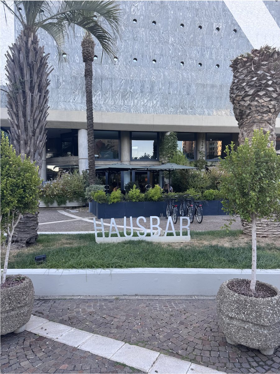
Tap “Start” and point your camera toward the HausBar sign.
- Hold the phone or tablet vertically.
- Avoid pointing the camera only at the floor.
- Wait a few seconds for localization and AR content to load.
If localization fails, move to another position within the scanned area and repeat the localization step.
Step 4: Place the OGC Logo
Select “Create Item” from the app menu. Enter “OGC” in the search field, choose the OGC (GLB) logo, and tap “Select.” Then tap the screen to place the logo at your desired location.
Congratulations! You have placed a 3D OGC logo in GLB format.
Step 5: View the Content in MyGeoVerse
Restart MyGeoVerse and repeat Steps 1–3 to localize. View the OGC logo at the location where you placed it.
Next, view the same content using the spARcl WebXR spatial browser.
Step 6: View the Same Content in spARcl
- Open our spARcl WebXR app in Android Chrome: https://sparcl.orbit-lab.org/ or scan the QR code below.
- Enable WebXR Incubation in
chrome://flagssettings. - Enable Location access.
- Follow the instructions in the app.
Demo 2: GLB Content Interoperability
Publisher: Augmented City
View the same shared GLB content first in AC Viewer, then in spARcl using Augmented City VPS and OpenVPS.
| Spatial browser | Localization method |
|---|---|
| spARcl by Open AR Cloud | Augmented City VPS or OpenVPS by Open AR Cloud |
| AC Viewer by Augmented City | Augmented City VPS |
Demo 2: Step-by-Step Instructions
Step 1: Open AC Viewer
Go to the AR experience starting point and open AC Viewer. Don’t have it yet? Download AC Viewer at the bottom of this page. After installing, open the app and grant the requested permissions.
Step 2: Localize
Go to a previously scanned area, such as the area near the Nicolaus Hotel.
Tap “START AR” and point your camera toward the Hotel.
- Hold the phone or tablet vertically.
- Avoid pointing the camera only at the floor.
- Wait a few seconds for localization and AR content to load.
If localization fails, move to another position within the scanned area and repeat the localization step.
Step 3: Place a GLB Model
You can add a GLB model in AC Viewer and then view it in spARcl. Some of the existing content is already available in spARcl because it was placed in GLB format.
A custom model should be small and lightweight, hosted online, and accessible through a direct GLB URL entered in the Path field. You can also use the example model below.
- Open the two-line menu in the top-right corner.
- Select “Settings” → “Authorization”.
- Log in with the demo credentials provided by Augmented City exclusively for this demo:
Login:augcitydemo@gmail.com
Password:ACdemo2026 - Wait for “You are logged in”.
- After the app restarts automatically, tap “START AR” and localize again.
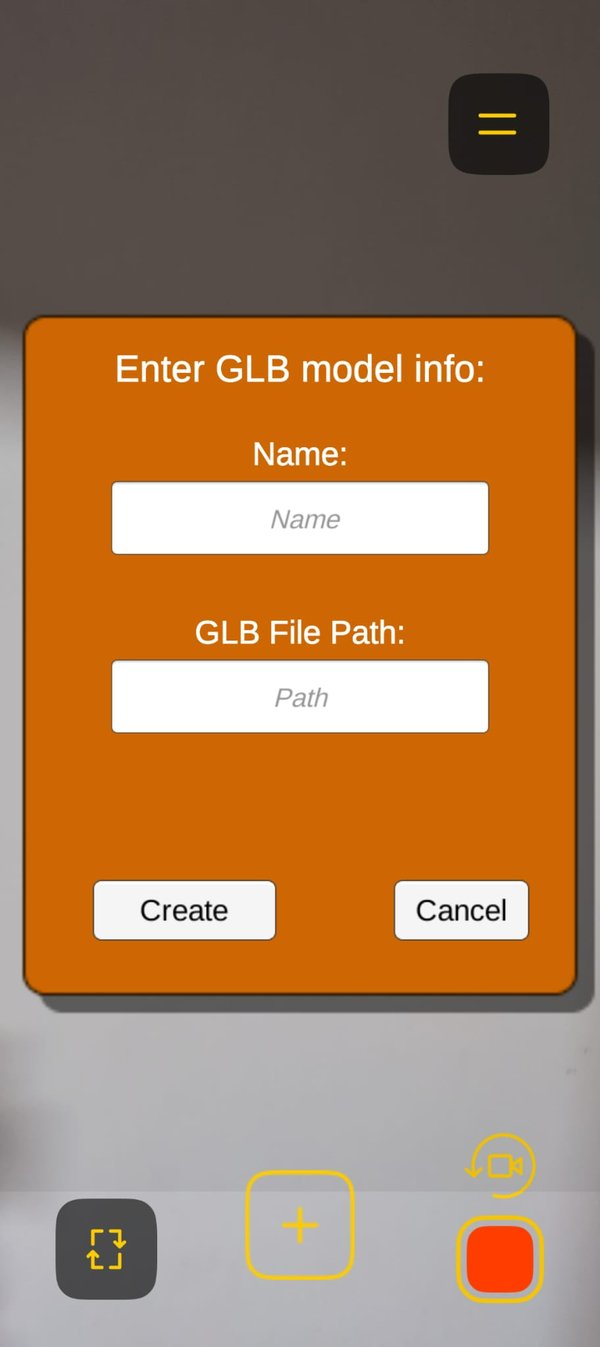
- Tap “+ ADD GLB from path”.
- In Name, enter your name.
- In Path, enter the example model URL:
https://raw.githubusercontent.com/mdivietrolt/models/main/ISMAR-ac-mongolfiera.glb - Tap “Create” to load the hot-air balloon featuring the Augmented City logo.
- Tap “+ ADD” to permanently place the model at the scanned location.
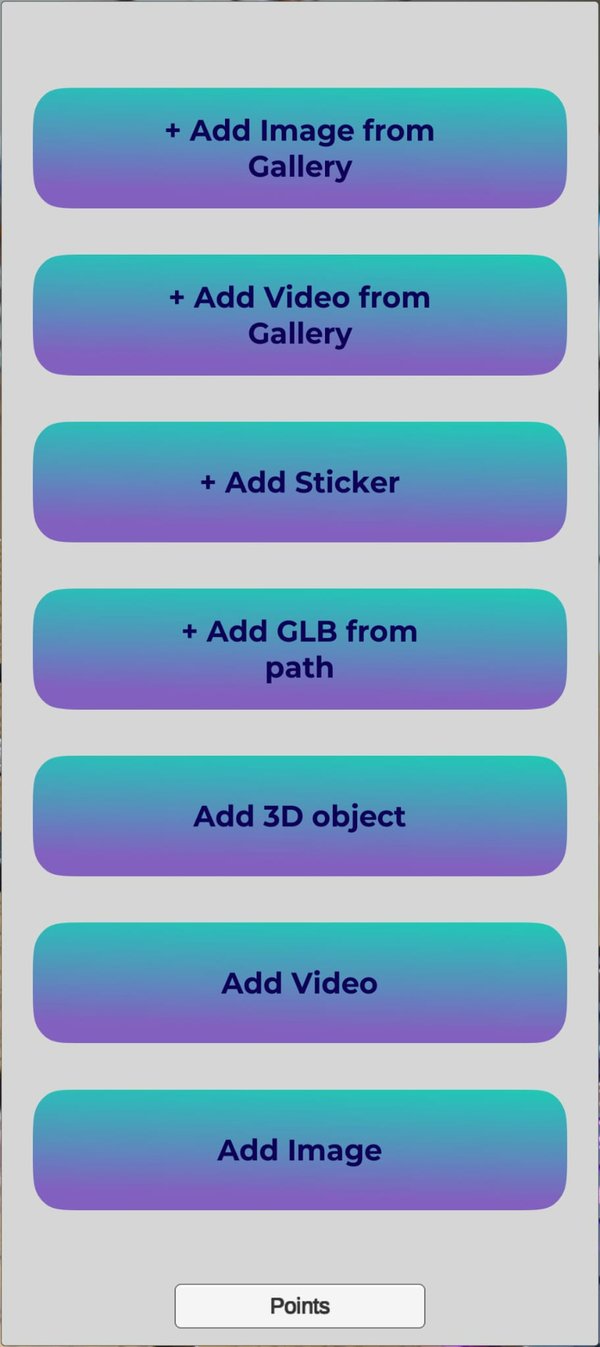
Congratulations! You have placed content with AC Viewer.
Step 4: View the Content in AC Viewer
Restart AC Viewer, tap “START AR”, and localize again to view the content you placed.
Step 5: View the AC content in spARcl Web App
- Open https://sparcl.orbit-lab.org/ in Chrome on an Android device.
- Select “AugmentedCity Content ISMAR2026”.
- Enable “AC GeoPose ISMAR26” to use AC VPS. Alternatively, enable “OpenVPS GeoPose ISMAR2026” to use OpenVPS for localization.
Download the Apps & Open spARcl
spARcl runs in the browser, so there is nothing to install. AC Viewer and MyGeoVerse are native mobile apps.